Slovenia Trip
We went to Slovenia for a week at the end of July. I have come to the realisation that I forget too much about some of my other trips, instead piecing things together based on photos when I look at them years later. In an attempt to change this a little, I thought I’d write some thoughts about it down. Maybe just go full diary-with-pictures at it. A lot of the trip was running and walking around, so it seemed fitting enough to post it here. In total we ended up spending seven days there that I could say something meaningful about, so I will just go through those one by one. (We arrived late the day before day 1 and just immediately went to bed)
I wrote all of this in the weeks following the trip and selected photos at the time too. Then I completely ignored finishing the report till I figured at the end of December that I really should get it done. I processed the photos and did a final proofread… and ignored it for a while longer still. Procrastination at its finest.
Day 1: Lost in the Woods and Too Much Hiking
A Run
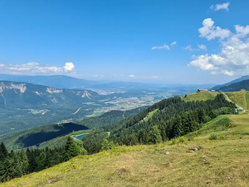
I had only planned a 10k run this morning and spotted a loop on the map that would take me through some forests as well as the next town over. The parts in the forests were not marked trails. I was not aware of this fact, nor did I realise it actually mattered. Instead these seemed to be paths used for logging and, as such, were not quite as consistent with the map as I had hoped. I think they might change on a yearly or similar basis. My original path ended up stopping in a tree wasteland.
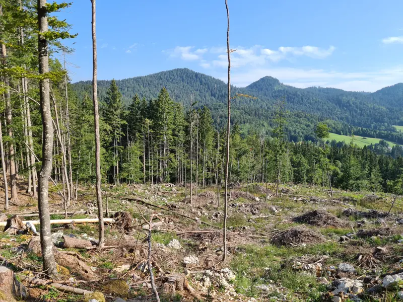
No worries, there was a side path that seemed to get me in largely the right direction! I followed that instead. Repeat this process a few times. Eventually, only a slow and steep 1.6 km into the run, the path ended at a horse pasture with fencing. I did not feel like going back the way I came and instead spotted another steep upwards path that looked passable. Half a km further this ended in another tree wasteland, it was just another logging path.
Kind of sick of this, I just decided to push straight through the woods up ahead. There was no path, but (1) I figured it was generally the right direction, and (2) I was hoping there might be a path popping up that was not on the map. As luck would have it, a path did appear! I followed this for a while, thinking it would lead somewhere. It did. You guessed it. Another tree wasteland. However! In the distance I could make out an actual asphalt road, so once more I decided to just push through the woods. Slow going, but the right direction. I was a bit over this forest run. I ended up finding some fields, running straight through those and making it to the road in the end. I was maybe 3 km into the run and 40 minutes had passed. Whoops.
After that I stuck to some roads, found an actual marked trail up to a view point, and finished the rest of the 10 km in less time than those first 3 km had taken me.
A Hike
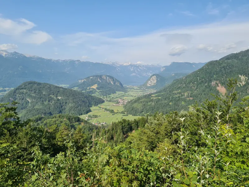
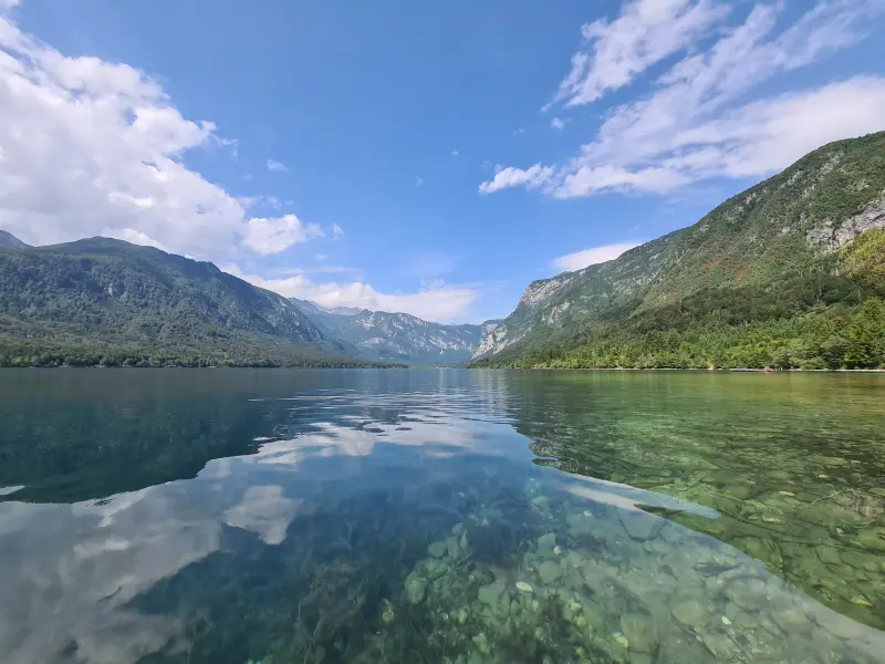
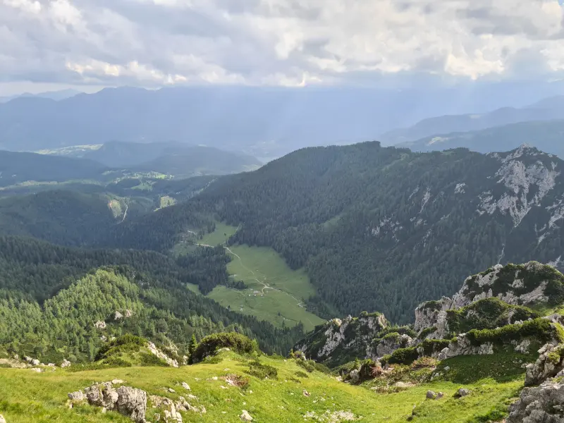
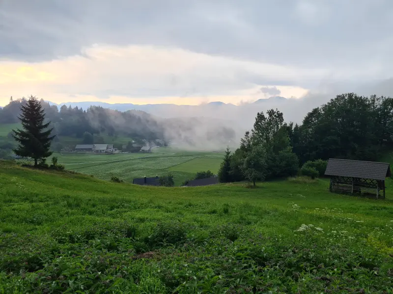
The hike planned today started in the village of Stara Fužina, next to Lake Bohinj (Bohinjsko Jezero). We would end up here a few more times this trip. From Stara Fužina, we went north-westish to climb up to Vogar. I am still not sure if this is an actual named hill or the name of the few houses at the top there. Either way, it was upwards from where we started. Steeply upwards. We climbed around 500 vertical meter, most of it across a 2.5 km stretch. That makes it pretty steadily around 20%. I am not sure what I expected on this trip, but that was a bit of a rougher start than anticipated.
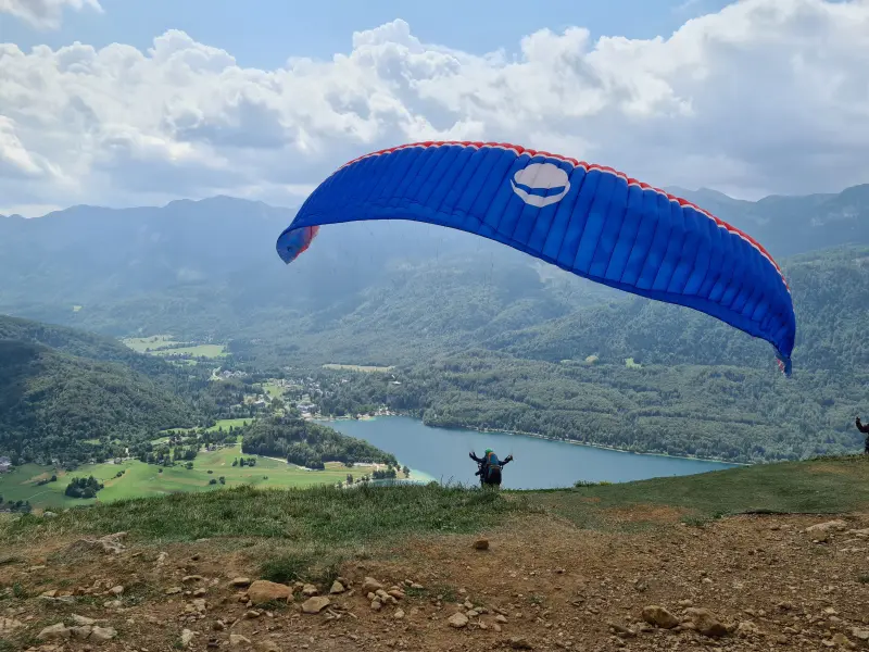
There were two nice viewpoints at the top and we watched paragliders take off from the side of the hill for a while. A nice and relaxing moment for us, before we bombed back down ourselves, no easy feat at that steepness. The terrain was also very rocky, so you had to keep paying attention throughout. All in all that ended up being a nearly 9 km walk with over 2h30 of moving time. Legs were tired from the steepness, but I figured that was it for the day.
We immediately went to a restaurant in the village there (Residence Triglav 🌍 lat: 46.28408 lon: 13.89142 ) which is a bit pricier than most places in this part of Slovenia, but was pretty fancy and looked nice.
A Hike Too Many
After that we went to the village of Bled, known for its lake (Lake Bled, Blejsko jezero) with a church on the island in the middle. I figured it would just be some sightseeing and scoping out a place for the girlfriend, who had to work the next day and needed a place with better WiFi than our Airbnb provided. We walked a little bit, had a drink in a café that seemed to have good WiFi for tomorrow, then continued walking some more. The plan was to stroll around the lake a bit.
The stroll turned into a “let’s climb this mountain on the other side” when we passed by the west side of the lake. Apparently there were three viewpoints up there. When the girlfriend and her sister had made this trip about two years ago, they had only managed to do one of them, getting lost after that and not caring enough to press on. So up we went.
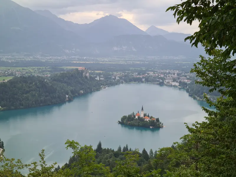
The view is nice enough, you see the lake from above, you get a good view on the church on the island in the middle. Postcard picture. The different view points were all pretty much the same to me though, so that got less interesting. Legs were also not very happy any more: getting to the viewpoints meant more climbing. Either way, we managed them all, climbing from just under 500m elevation to about 750m of elevation in the span of 2ish km. Yup, that was steep again. Once done, we still had to walk back along the lake to the village again too.
The Bled walking ended up totalling about 10km, 3 hours of moving time. By the end we were all pretty done with it and dragged ourselves to an Asian restaurant, no local cuisine tonight. After stuffing our faces, we felt better, but I was definitely hoping not every day would end up like this.
Day 2: More Bled
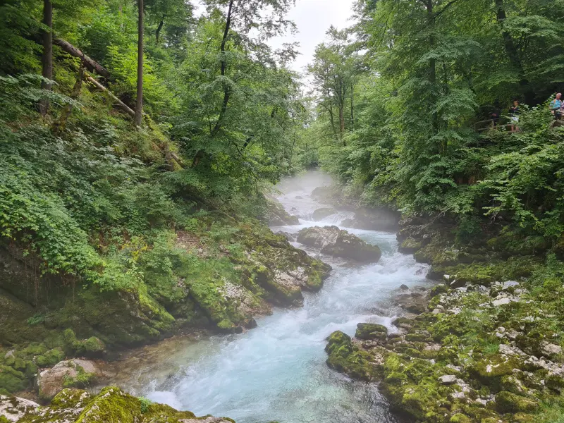
The girlfriend had to start work relatively early and I was not going to wake up early enough to squeeze a run in before we had to leave, so my run was pushed back to later in the day. We dropped the girlfriend at the café while her sister and I continued on to the Vintgar gorge (along the Radovna river) and the Šum waterfall at the end (“Slap Šum”, Slap being Slovenian for waterfall). The walk was pretty, the waterfall itself underwhelming. Coming at the end of July might have made there not be enough water to make it a nice sight. The girlfriend later assured me it had looked much better when she had gone there in a different season. Bummer.
After getting back, we went to the girlfriend to say hi and rest briefly. We then bought some lunch in the supermarket, checked out the castle on the north side of Bled, and finally the toboggan on the south side of Bled. Looking back at this, the walking was not super crazy, but my legs were a bit fed up with the apparent need to keep moving. I ended up walking nearly 14 km total.
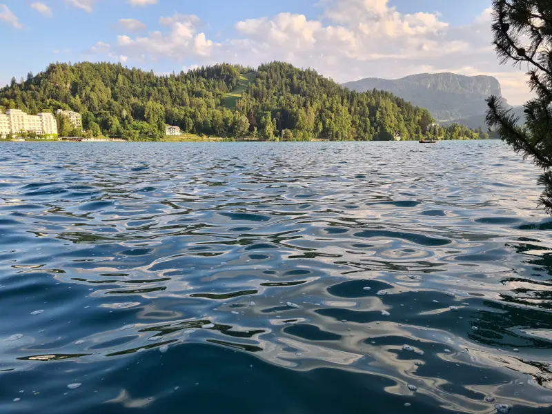
Once the girlfriend was done work, I changed into running clothes. She and her sister would walk around the lake, I would run two laps to get to 13 km. After I finished that, I jumped into the lake to cool down and wash off the worst of the sweat. The water was not too cold once you were in, luckily. Taking a lake “bath” ensured I did not have to shower and we could immediately continue on to dinner. Tonight’s dinner was more traditional, in the “Gostilnica Štrudl” ( 🌍 lat: 46.27262 lon: 14.95303 ) where I consumed too many strudls and had some nice local craft beer (Jezernik Summer Ale by Lintvern brewery).
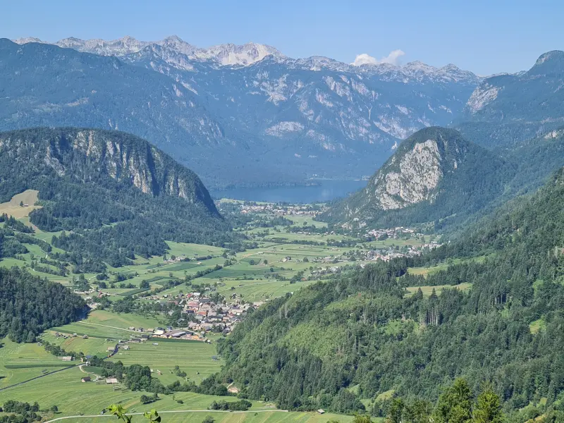
Day 3: Lake Bohinj and Viševnik
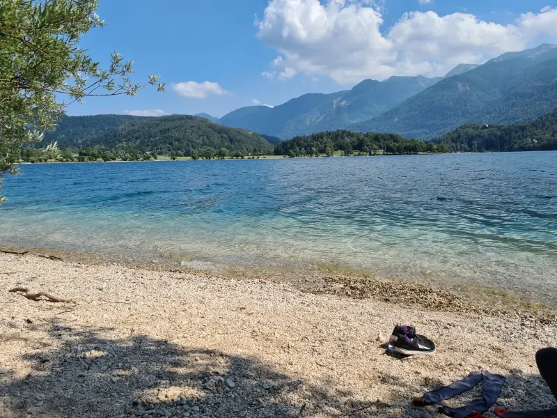
On this day, the girlfriend needed to work through the morning. She found a bench in Stara Fužina, her sister went for a walk, and I went for a run. Having done Lake Bled the day before, I decided to run around Lake Bohinj (Bohinjsko jezero) today, another ~13 km run. The south side of the lake was a bit meh to run along, there was a gravelly path, but there was a road for cars and a small treeline between you and the lake. The north side was nicer, a more traily experience, no cars, just nature and lake. Once the run was done, I dipped into this lake too for a rinse. I had time to waste waiting for the girlfriend, so I chilled in the water and on the beach for just shy of an hour. The sun was shining so the water was quite nice. Just don’t go deeper than 1m50 or so, it quickly cools down significantly. Cold mountain water I presume. The area can get pretty crowded with people, but I was lucky to be early enough and had some peace and quiet. First truly relaxing moment of the trip? I enjoyed it, things had been a bit too intense so far.
Afterwards I made my way back to the girlfriend. I don’t know if it was something in the lake, but I was followed by a swarm of flies for almost a kilometer. If I did not wave my arms around, they would all converge on my arms and I would get a gross covering of flies chilling there. Seriously, really gross. When I reached the village they finally left me alone.
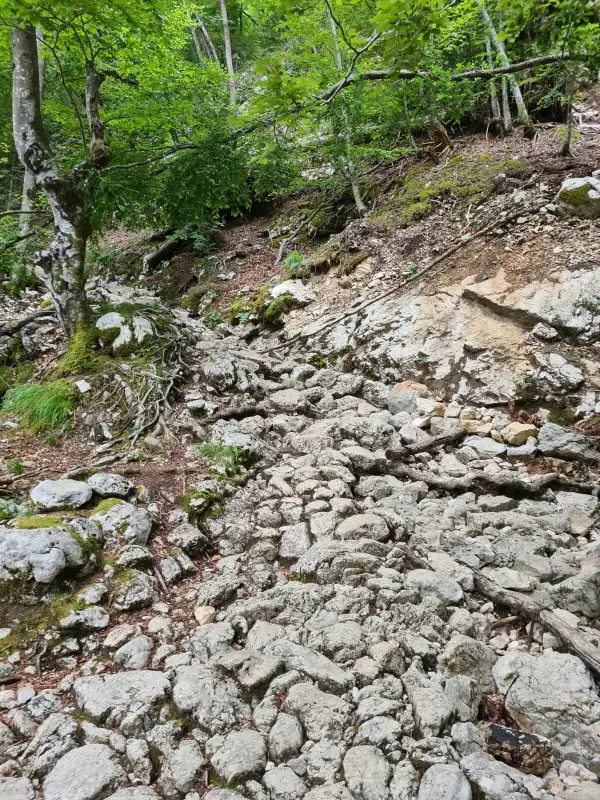
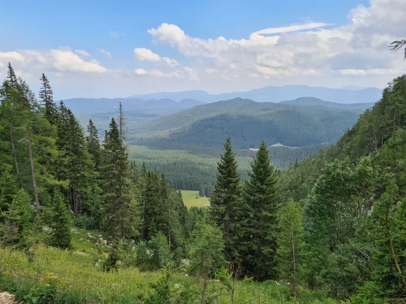
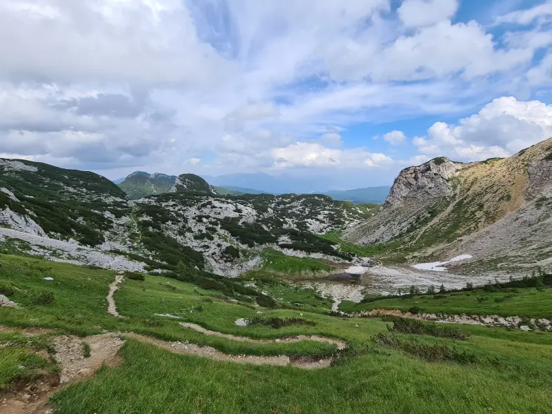
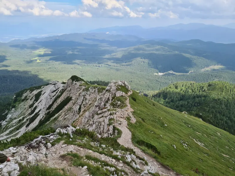
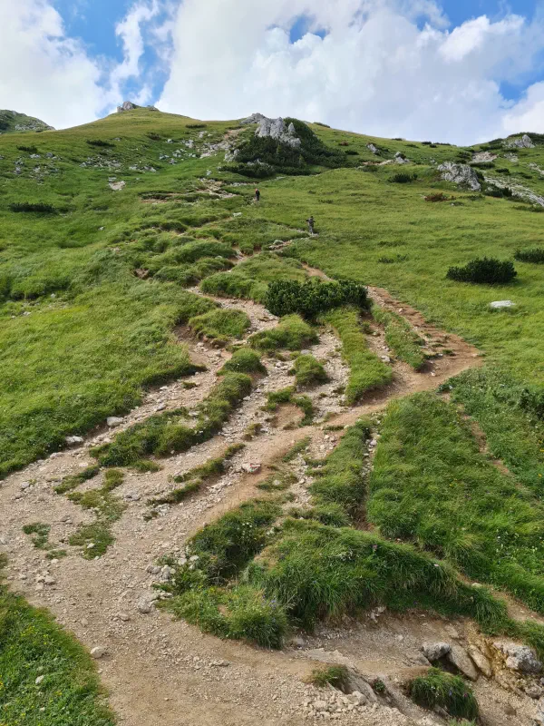
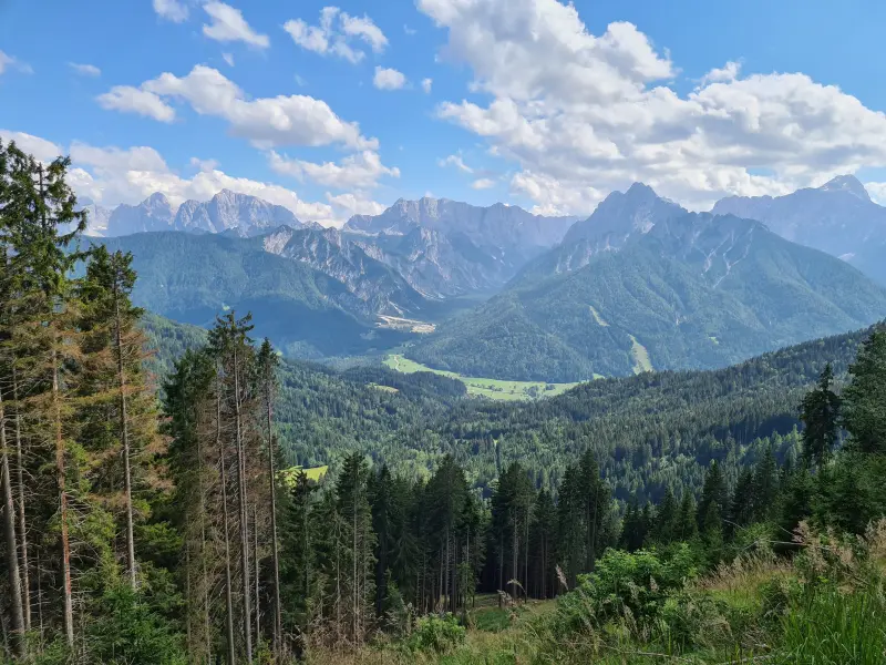
In the afternoon, a climb up mount Viševnik was planned. We started around 1400m of elevation at Rudno Polje. You can park in the collection of four buildings called Rudno Polje and walk a little bit extra, or you can park in the following spot right at the bottom of the ski slope and skip a small extra walk (🌍 lat: 46.3483 lon: 13.9156 ). We climbed up, first along that ski slope, but quickly on much more challenging rocky terrain as we left the ski slope behind. The first 1.2 km averaged about 25% if I calculated that right. Another day of steepness and paying attention to footing. The views were great though: hulking mountains and deep valleys on all sides. It’s just not something you find in Belgium. Downside: the steepness eventually got to my right achilles. I started feeling it, I had overused it a little. About 2/3rds up the climb the complaining started and I had to stretch and rest my legs a few times. I am not the most bendy at the ankles to begin with, I imagine this does not help when going up so steep a climb.
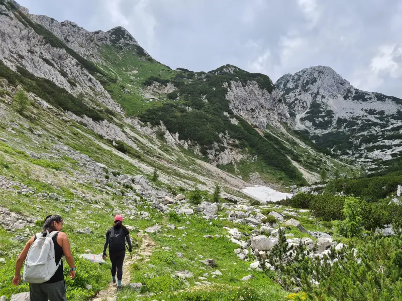
As we neared the top, we saw what we think is an Alpine Ibex. The horns were a bit short, so it would have to be a younger specimen (… or just some mountain goat). Evidently it was a bit shy so we could not get close for the most precise view, but until told differently, we assume it was one. It is the cooler story after all.
We got to the top eventually at 2050m of elevation. There was a couple sitting there enjoying the view. I overheard them and they were Belgian. Figures that you travel halfway across Europe and up a mountain only to find compatriots. I ignored them entirely, of course. We too enjoyed the views, took some pictures, had a snack, and finally prepared to get back down. I had an easier time bombing down than going up, so I just went at comfortable-for-me pace and waited from time to time for the girlfriend and her sister who took a more careful approach. The entire walked ended up totalling just 6.3 km, but took us 2h15 of moving (3h52 with all the breaks).
Afterwards we went for dinner in Penzion Resje, having some more local cuisine, and a local beer (Polesnjak by Lintvern brewery). I probably should have taken note of what we ate to make this paragraph more useful, but here we are. The server was really nice so if you ever pass by there, I hope you have the same service! We were eating outside and near the end of the meal it started thunderstorming and pouring down. Good timing. The drive back to the airbnb was an interesting one: paying attention in the darkness combined with rain to ensure we safely got back, but the lightning views were pretty amazing.
Day 4: Three Country Point and a boo-boo
Before this night I had mentioned that my body needed more rest and this one proved it. I slept in a bit. By the time I got up (9:25ish), I still felt very tired, and also a little grumpy about that too. But the morning was wasting away and I said I could postpone my run till later in the day, whenever and wherever we could fit it in. I figured we wanted to get the day’s hike started sooner rather than later.
🌍 lat: 46.5229856 lon: 13.7140622
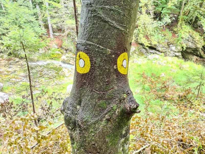
We drove to the north west corner of Slovenia, to the village of Rateče. From there, we climbed upwards to mount Peč aka Monte Forno aka Ofen, the three country point of Slovenia, Italy, and Austria. Coming from the Slovenian side there are two main ways to reach it, though you do not have to make that choice until you are a few km into the walk. The first option is the one we took going up and it is exclusively for walking. It is a series of, if I recall correctly, 30 switchbacks in a forest, constantly climbing upwards. A countdown for the switchbacks is painted on the trees, so at every turn, you know how many more you have to go. The second option is a wide gravel path that I think you can technically drive up, though I don’t recall much parking space to speak of at the top. It is also the way you would take when biking up and down. We took this way down to make it a bit easier on ourselves.
At the top is a border marker stone, some monuments aimed at promoting the friendship between the countries, and mementos of how the border used to be (read: more border guards, less happy friendship). The Austrian side also gives you a magnificent view on a big valley. Walk a bit further east from the border marker, staying on the Austrian side, and you will find two cafés/restaurants and a cable cart taking you up and down to the village of Arnoldstein. We hung around a bit at the top, had a drink and a bite in one of the two places, and eventually made our way back down the easier of the two Slovenian routes.
With the newfound knowledge of what border marker stones look like, we suddenly spotted quite a few of them indicating the Slovenian-Italian border. A sizeable portion of the path is right next to the border so you can spot them between the trees a few meters in.
By the time we got back down (13 km total, nearly 4 hrs), most of the day was already behind us. We did a quick stop at the Zelenci natural reserve. From their parking lot it is only a 400-500 metre flat walk to the main spot of this reserve. This made it a bit disappointing as it was overcrowded with instagram girls and people with no respect for nature. We quickly continued on to Lake Jasna, where I would get my run (again 13 km, I was keeping this week simple to keep the planning simple) in while the girlfriend and her sister would walk around a little. The run was… not ideal.
I quickly felt a rather strong need to poop (TMI? Suck it up, this is my blog), luckily getting to a toilet eventually. Soon I had passed by all the roads at the lake, and running around the lake was not an option: it was tiny and there were too many people. Instead I went up into the mountains. This went OK for a while, the path was a wide packed gravel path that could probably fit a car or two. Easy peasy. Figures that on that exact easy peasy path I manage to twist my left ankle while still being a while away from where we had parked the car. The ankle was not painful going upwards, but it was hell when running back down. I had to be real careful with it and was glad when I finally reached the car. The section where I twisted my ankle was basically flat and, as mentioned before, not very difficult terrain. Perhaps the tiredness was catching up to me in terms of not paying enough attention (I believe it was a small rock that caused the twisting) and the body being tired leading to easier injury.
We were going straight to another restaurant from here, so I still needed to clean myself. Third lake in a row, here I come! Sadly for me, the sun had set behind the mountains by now and the lake was cold. Really cold. I dipped my toe in and wanted to nope out of that. Eventually I braced myself and jumped in. The pressure change did not feel good on the ankle, but what was worse was the cold. You know that description people give of little daggers stabbing you all over your body? I found out that that is pretty accurate. I quickly grabbed the ladder to get back out and onto the little pier so I could dry myself. Clean enough!
We drove quite a ways back to our neck of the woods and stopped at a little restaurant (Gostilna Zatrnik) on the way from Krnica and our village. We arrived there rather late, but luckily were still allowed to order food. I got a bear stew (cause how often can you say you’ve had bear), which if I recall just seemed like the Belgian stoofvlees dish to me. There was also a big fluffy dog walking around who clearly knew what he could expect from the guests, he quickly came begging for some scraps. He got some in the end, thus perpetuating the begging cycle.
When driving back to Koprivnik after our meal, we noticed how clear the sky was. This was the first night where this was the case, so we looked for a good spot and parked on the side of the road to look at the night sky. Compared to Brussels, the view was magnificent, reminiscent of our trip in the Mojave Desert. You could easily see the Milky Way, enough stars to make me confused about which constellations I was looking at, and near the horizon we also spotted a bright blob that I later figured out was probably Jupiter. I wish there wasn’t so much light pollution in Belgium, some more stargazing would be nice.
Day 5: Cannot Move Much
It was pretty clear from the moment that I got out of bed that I would not be running or doing crazy walks today. The left ankle I had twisted the day before was still pretty painful, especially when put into weirder positions. I might have been able to put it through a gentle run, but I decided to be responsible and not push my luck.
We did a brief (and for me: careful) walk to the viewpoint at the edge of the village (remember the run on the first day?). By noonish we had done some shopping in a supermarket in Bohinjska Bistrica. Next we went west a little to park the car just outside of Ribčev Laz and walked into and past the village to get to… Lake Bohinj again. I had said how chilling in this lake after my run had been one of the nicest and calmest moments of the trip for me so far. The girlfriend combined this knowledge with the fact that I had said all the hiking was not fun any more because it was just too endlessly intense. I like some chilling on my vacations and we had had none of that. Thus an afternoon at the beach of the lake. It all felt a bit forced to me. I also thought the girlfriend and her sister would ditch me immediately for a walk. So all in all I was not looking forward to it much. Add to that a veritable mass of other people being out to enjoy the beach. Meh. After an hour or two I finally chilled out some. Afterwards we went to a bar nearby (Karakter Bar), had some drinks (two more from Lintvern brewery: Black IPA and Bohinjski Čatež), played some card game (Go Sushi or something?), and stuck around long enough to eventually have dinner there too.
After dinner we went back home and I got very tired and moody again. Maybe I was just exhausted: as soon as we were back at the airbnb (maybe 21:00, likely earlier), I just dropped in bed, ded.
Day 6: T-storms and another Gorge
The ankle felt good enough to run in the morning and we were taking the morning easier than usual too (earlier complaining about the busy schedule having some effects?), so I could just have a go immediately without holding up any plans. I figured I would do 10 km max, to not overwork the ankle. I also figured I should not go too far so that I could easily walk back if necessary. Running felt fine, the ankle was holding up, and I figured I could do the full 10 km. About 5.5 km in, it started raining hard. Thunder and lightning followed quickly. As soon as I had felt it starting to pour, I had gone into the nearest shed. I figured it would blow over soon and I could be on my way.
“Soon” ended up being around 25 minutes of constant thunders. With the lay of the land between me and the airbnb (only about 1 km but a wide open field), I was not going to risk anything and just stood around. Eventually it cleared up some and I made a beeline home. I might have kept running nearby but I had lost the mood after all the standing around and was somewhat worried about being caught in a new stormfront. Just 6.5 km in the end. Bummer but oh well.
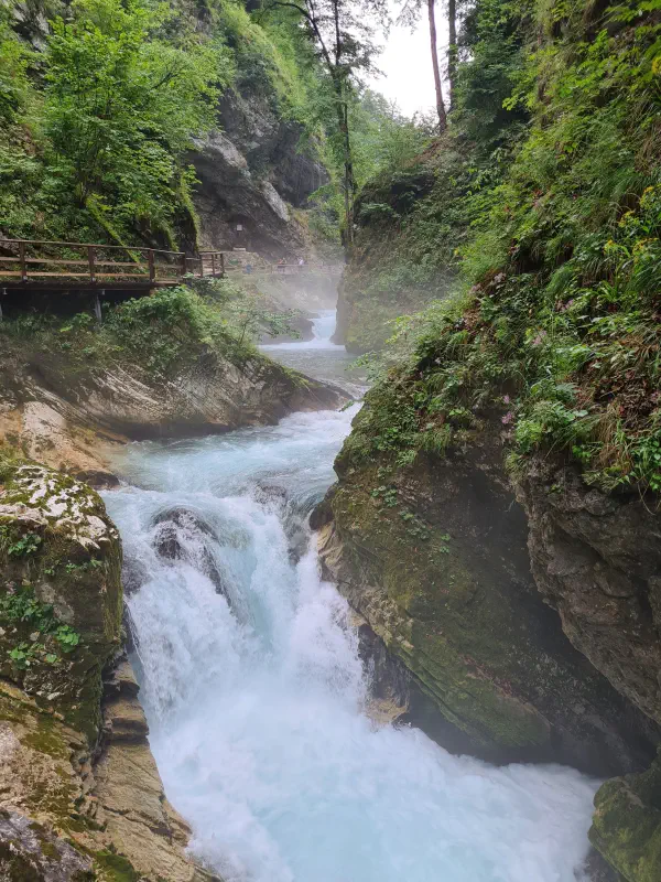
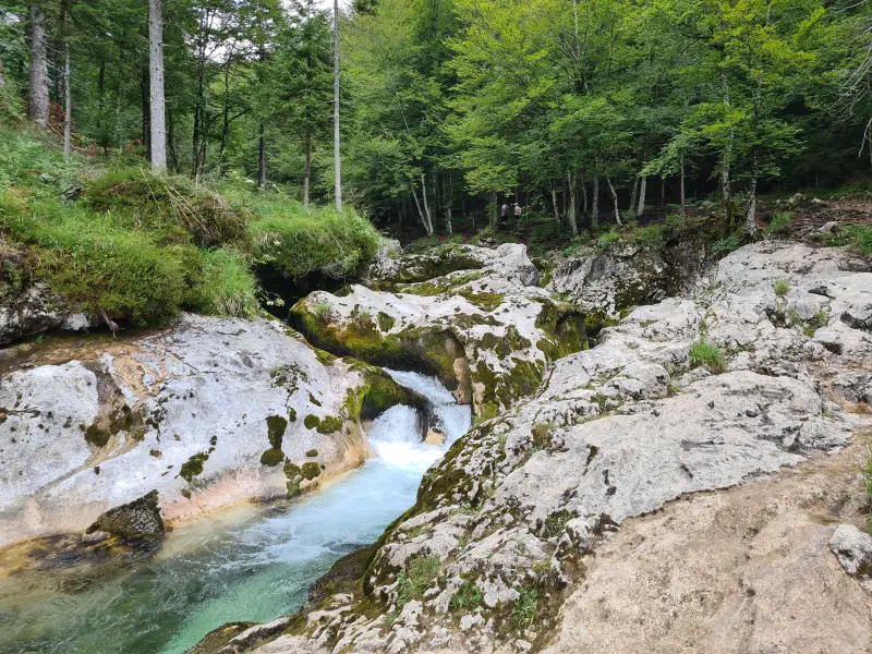
Afterwards we went for a walk north of Stara Fužina, along the Mostnica gorge. Not too much elevation and not very technical, which was probably the way to go for my ankle. Pretty enough to look at, without being that much effort. At the halfway point we stopped for some lunch (for me anyway) at a little restaurant/café (Planinski Dom 🌍 lat: 46.31012 lon: 13.88258 ). I got some sort of stew/barley wheat soup with sausage and bread. I believe the correct Slovenian name is Ričet. A proper hearty meal, I’m a fan. With the lunch downed, we continued further north to the Mostnica waterfall (Slap Mostnica). It looked more impressive than the Slap Šum waterfall from day 2, but that was not a tall bar to clear. We took some pictures and walked back. Ended up being nearly 10 km of walking, but pretty easy compared to other days.
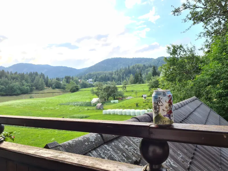
We had a relatively early dinner at a restaurant & pizzeria (🌍 lat: 46.26795 lon: 13.90982 ). I think I had another stew-y dish and half of the girlfriend’s pizza. It was OK, but the lunch stew had been better. Also got a beer (Villacher Dunkel), but that was a bit disappointingly flat. Either way, we decided to make it an early night back to the Airbnb and made it home before 20:00. Earliest night so far. Ended up chilling on our balcony: nice mountain views and some beers I had bought earlier in the week. Might be the first day that I truly felt was a relaxing day. Figures that we’d be heading home the next day.
Day 7: Ljubljana
My body decided to wake up much earlier than all previous days (6ish?), so I downed some food and went for my run. Shocker, I know. I decided on about 13 km (why always 13 km you may ask? It takes me about an hour so it feels right), I was still a little bit weary about the ankle so did not want to throw my long run at it. I had already given up on this week anyway in terms of good running. Hope the hiking compensated a little bit for the missed running. I ran up nearly 300m to reach the next village over, which was much too steep to be pleasant running. Then I ran around a peat bog up there and some more loops in the area to get my distance up (this area was somewhat flat). Afterwards I bombed back down the climb. No crazy forest attempts today like on day one, I did not want to be too late for checkout accidentally.
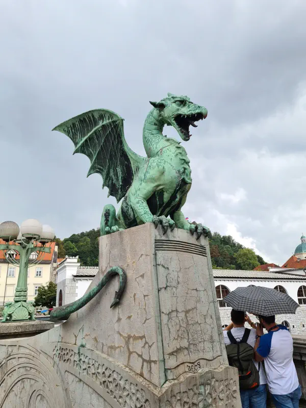
We checked out of the Airbnb and drove to Ljubljana. Planned for the day: some chilling and sightseeing while waiting for our plane, which would not depart till pretty late in the evening. We did some walking around the city centre, spotting a bridge with dragon statues. The city seemed big on dragon symbols. We had some lunch and then walked up the hill to the castle. We looked around and chilled a bit up there, before taking the long way back down. On that long way, we got caught in a downpour and hid under a bridge for a while for it to stop. The Airbnb had given us some homemade liquor at checkout, so we had a little hobo picnic under that bridge. When the rain stopped, we walked on, and came across some international beach volleyball tournament that was happening on one of the squares. We looked on for a set, but did not care that much either, so we continued on. Saw some more things, found a place for dinner and a drink. We took our time with that because the plane was likely to be delayed. Afterwards we got an ice cream from a pretty fancy place with some exotic sounding selections. If you are ever in Ljubljana, you might as well check them out. They’re called “Cacao” (🌍 lat: 46.0515768 lon: 14.5071166 ) and are located in the centre, near the Tromostovje bridge across the Ljubljanica river. After all that, we made our way back to the car (totalled about 9 km of walking around Ljubljana) and from there to the airport. Had to wait quite a while for our much delayed plane, but in the end we got back home safe and sound.
Parting note: the entire week I finished maybe 2 streets in Citystrides (see Heatmap Goals), mostly because roads in tiny villages in Slovenia do not get a name, a house just has village name, number as address. The walking around Ljubljana finished about 25, because streets did have names there.
Parting parting note: If you want more detail on parts of this trip in order to plan your own, feel free to shoot me a message.
Parting parting parting note: As you perhaps can tell, the photos are compressed down a bunch to save bandwidth (yours and mine). If you want any in better quality, I do still have the originals.